Mullerthal Trail Route 3: Two day hike in Luxemburg
Last April, I hiked Route 2 of the Mullerthal Trail. The scenery was so beautiful that I wanted to come back this year and try a different section.
The Mullerthal Trail consists of three routes. You can hike them all together or choose one at a time. This year, we picked Route 3.
Route 3 of the Mullerthal Trail leads you through different landscapes. You walk through forests that feel like something out of a fairytale, pass fields and farms, encounter big rock formations and waterfalls, and sometimes go through small villages.
In this blog, I’ll tell you about my two-day hike on Route 3. I’ll share my experiences, how I planned the route, where I stayed overnight, and tips to help you get ready for the trail.
Table of Contents Show


Information about the hike - The Mullerthal Trail Route 3
Location: Mullerthal Region in Luxembourg
Start of the trail: There are different starting points, including Mullerthal, Blumenthal, Larochette en Beaufort.
Accessibility: You can reach the trail by both car and public transport.
Distance: 38 km
Route description: Click here for a Komoot map or download the GXP file here.
Difficulty: The route is not too challenging. But a good level of fitness is requierd as there are some steep paths uphill.
Want to learn more about the entire Mullerthal Trail? Click here for a detailed blog post that explains the sections, routes, what to expect from the trail, and answers to common questions.
Two days on the Mullerthal Trail Route 3
It was a rainy Friday afternoon when I arrived at Camping Park Beaufort in the Mullerthal region. I chose the campsite as the base and planned to take the bus to and from the trail. The free public transport in Luxembourg made this really easy.
After pitching my tent and grabbing a quick dinner, I went to bed early so I’d be rested for the hike. The gentle sound of rain on the tent helped me fall asleep quickly.
Day 1 on the Mullerthal Trail Route 3
I started the first day by waking up around eight. After having breakfast and taking a warm shower, I packed my backpack and got ready for the hike.
I walked a short distance from the campsite to the bus stop, then took the bus to Heffingen to begin the hike. Even though the forecast called for bad weather, fortunately there were only a few light drizzles. The path was still slippery and muddy, so I was glad to have my walking sticks for extra support.
The trail started through the woods, then passed through the village of Larochette, where I saw the first castle along the route. This part of the trail consisted mainly of woodlands and stretches along fields and farmland.

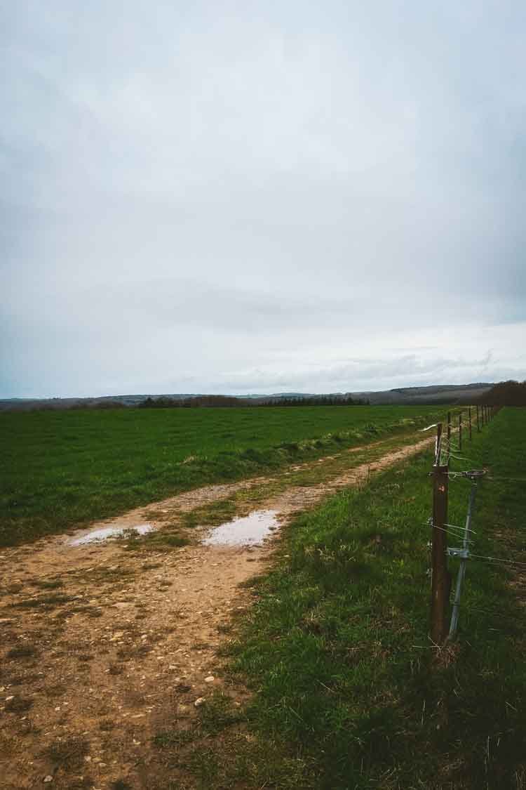

For me, the day got more interesting in the second half. From that point, the path led me through a beautiful forests and along stream valleys (see the first two photos below).
In the afternoon, the route followed streams and brooks, and sometimes I had to cross them. The ground was a bit challenging at times because the stones were slippery.
I also passed the second castle on the route, the ruins of Burg Beaufort (see the third photo below). This stretch of the trail was really beautiful and made for a great end to the day. Around five o'clock, I reached Grundhof and took the bus back to the campsite.


Day 2 on the Mullerthal Trail Route 3
On the second day, I woke up to beautiful sunshine. I took the bus the starting point of the day. The sunny weather stayed with me, and as I walked through the woods, sunlight filtered through the trees.
The beginning of this section took me through a beautiful forest scenery. Soon, I reached the village of Mullerthal, which is also part of route two. There are several waterfalls along the way, but the area is quite touristy and busy.
Because of construction, I had to take a short detour to rejoin the trail. Luckily, the signs made it easy to find my way.


Because of the rain, part of the detour I had to take uphill turned into a big mud puddle. It took me a while to figure out how to get up safely. I wans’t the only one having trouble; some people even turned back.
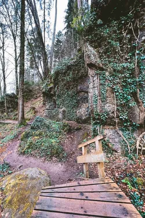
Once I finished the short climb, I got back on the main trail. I walked through leafy forests for a while, and by the afternoon, I reached a beautiful coniferous forest just before Blumenthal (see the three photos below).
Here, it felt like I had stepped into a fairytale. I was surrounded by huge trees, mossy ground, and interesting rock formations. This was my favourite part of the trail. The coniferous forest eventually gave way to another leafy forest, where I had to walk up a few more paths that weren’t too steep.
After one last tough climb, the path took me through the countryside for a few more kilometres. The hike was almost over, and I hoped it wouldn’t finish out in the fields.
Luckily, the very last stretch took me through the woods before reaching my end point.


Preparations for the Mullerthal Trail Route 3
Accessibility of the Mullerthal Trail route 3
Route three is not too challenging. There are a few uphill sections, but they aren’t very steep. Most people hike this route in two days, but you can take as much time as you want. This way, you can adjust the hike to match your own pace.
The entire Mullerthal Trail is clearly marked with red M signs. At crossroads, you’ll often see signs telling you how many kilometres are left to the next stop. So, you don’t need to be great at reading maps. Still, I always suggest bringing a digital or paper map as a backup, just in case you miss a turn.
The route takes you through both nature and small villages, so you’re never too far from civilisation.
Before you start, check the weather forecast. The trail can get slippery and muddy when it rains, so keep that in mind when picking your clothes and shoes.


What to pack for the Mullerthal Trail route 3
If you’re curious about the gear I take on my camping and hiking trips, you can check out my full gear list here.
Here are a few tips I have for Mullerthal Trail route 3:
Because the terrain is rugged, I definitely recommend hiking boots with good grip. Some parts can get slippery or muddy, especially after rain.
There aren’t any water stations along the trail, so be sure to bring plenty of water with you.
On this trail, you’ll walk next to and sometimes even through streams. Bringing an extra pair of socks, or waterproof socks, is a really good idea.
If you want some extra support, consider bringing walking poles. I found mine really helpful on the uneven ground and during the climbs and descents.
If you don’t want to spend too much, Decathlon has good walking poles (MT500) for about 18 euros each.
Dress in layers so you can adjust to the weather easily. I always use merino wool for my base and mid-layers. It keeps you warm or cool as needed, and since it’s antibacterial, it doesn’t start to smell.


How to access the Mullerthal Trail Route 3? Parking and public transport
You can easily reach the Mullerthal Trail by car or public transport. From Utrecht in The Netherlands, you can reach the trail in about 4 hours. This makes it a great option for a weekend trip.
In Luxembourg, public transport is free. In most of the villages along the route there are bus stops, making it easy to use the bus during your hike.
Popular starting points of the Mullerthal Trail Route 3 are Mullerthal, Blumenthal, Larochette, and Beaufort.
Where to stay along the Mullerthal Trail Route 3?
You’ll find plenty of places to stay along the trail, including hotels, B&Bs, hostels, holiday homes, and campsites. Some places offer extras like packed lunches, laundry, or shuttle service for an additional fee.
I stayed at Camping Park Beaufort, which is a large campsite with clean, modern bathrooms. If you’re only staying a short time, the hiker’s field is an affordable option.
Other campsites in Larochette include Camping auf Kengert and Hu Birkelt Village.
If you prefer a B&B, White Pearl in Mullerthal is a good choice. They also have a holiday home for rent in Beaufort.
Hotels along the route include Hotel Brimer in Grundhof, Hotel Meyer in Beaufort, and Hotel Le Cigalon in Mullerthal.
There are also two youth hostels nearby: Youth Hostel Larochette and Youth Hostel Beaufort.


2-day plan for the Mullerthal Trail Route 3
Below you will find the route map of the two-day hike I did on the Mullerthal Trail Route 3.
Are you planning to hike Mullerthal Trail Route 3? Do you have any questions? Feel free to leave a comment below this post or send me a message! 😊
More inspiration and information about the Mullerthal Trail:
Hiking guide for the Mullerthal Trail: Tips, routes & more