Hiking guide for the Mullerthal Trail: Tips, routes & more
The Mullerthal Trail takes you through the scenic Mullerthal region in Luxembourg. People often call this area ‘Little Switzerland’ because of the dense forests, streams, caves, and rocks formations. The trail consists of three loops that can be hiked seperate or combined as one long distance hike. The Mullerthal Trail is perfect for lovers of nature, culture and history.
In this blog, I’ll give you an overview of the whole trail. I’ll talk about the scenery and terrain, the level of difficulty, how to prepare, how to get there, where to stay, and more.
Table of Contents Show

Sourcen: berdorf.be
An overview of the Mullerthal Trail
Located in the heart of Luxembourg, the Mullerthal Trail is an enchanting hiking destination known for its beautiful scenery and unusual rock formations. The trail leads you through enchanting forests, past flowing streams, deep gorges, and tall rocks. It is a great choice for anyone who enjoys hiking and nature.
Besides its natural beauty, the Mullerthal Trail gives you a glimpse into the area's history and culture. Along the way, you will find historic sites, small villages, and traditional buildings.
The Mullerthal Trail covers 112 km in total and is split into three main routes. Route 1 is 36.7 km, Route 2 is 39 km, and Route 3 is 38 km. You can hike each route individually or combine them. All three are circular walks. Routes 1 and 2 meet in the city of Echternach, while Routes 2 and 3 cross paths in the village of Mullerthal.
Besides the three main routes, there are four extra routes. You can combine these with any of the main routes or walk them on their own.
Each route on the Mullerthal Trail has its own unique features and difficulty level. Here is a short overview of the three main routes and the four extra routes.

Mullerthal Trail Route 1
Mullerthal Trail Route 2

Mullerthal Trail Route 3
Mullerthal Trail Route 1
Mullerthal Trail Route 1 is a great choice if you like a mix of nature and culture. Along the way, you’ll walk through forests, see rock formations, and pass through scenic valleys.
Route 1 is 36.7 km long and has the least elevation gain of the three routes. It takes you through the city of Echternach and the villages of Rosport, Hinkel, Moersdorf, Mompach, and Herborn.
Highlights along Route 1 include the Tudor Castle and its museum in Rosport, the Girsterklaus pilgrimage chapel, the Kulturhaff Millermoler cultural farm in Hinkel with a tea house and shop, and the historic centre of Echternach, where you’ll find the Basilica of St. Willibrord and more.
You can read my detailed report about hiking the Mullerthal Trail Route 1 here.

Culture in the city of Echternach

View of picturesque villages

Beautiful forest
Mullerthal Trail Route 2
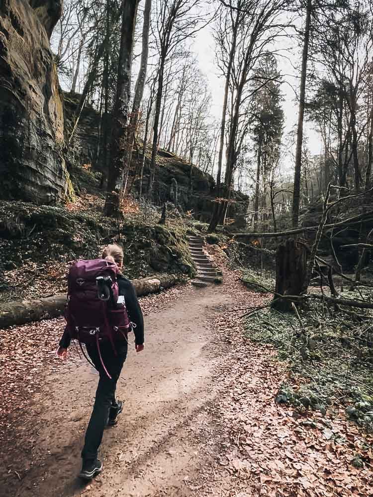
If you want to really experience the beautiful nature of the Mullerthal region, I highly recommend the Mullerthal Trail Route 2. The trail is 39 km long and takes you through the heart of Luxembourg's ‘Little Switzerland’.
Along the way, you'll see amazing rock formations, forests, and waterfalls. The trail also passes through the villages of Berdorf, Mullerthal, Hersberg, Scheidgen, and the city of Echternach.
Some highlights along the route are the rock crevices near Consdorf, the Schéissendëmpel waterfall in Mullerthal, Huel Lee, which is a man-made cave in Berdorf, and Trooskneppchen, where you get a great view of Echternach and the Basilica of St. Willibrord.
You can read a detailed report about my experience on the Mullerthal Trail Route 2 here.
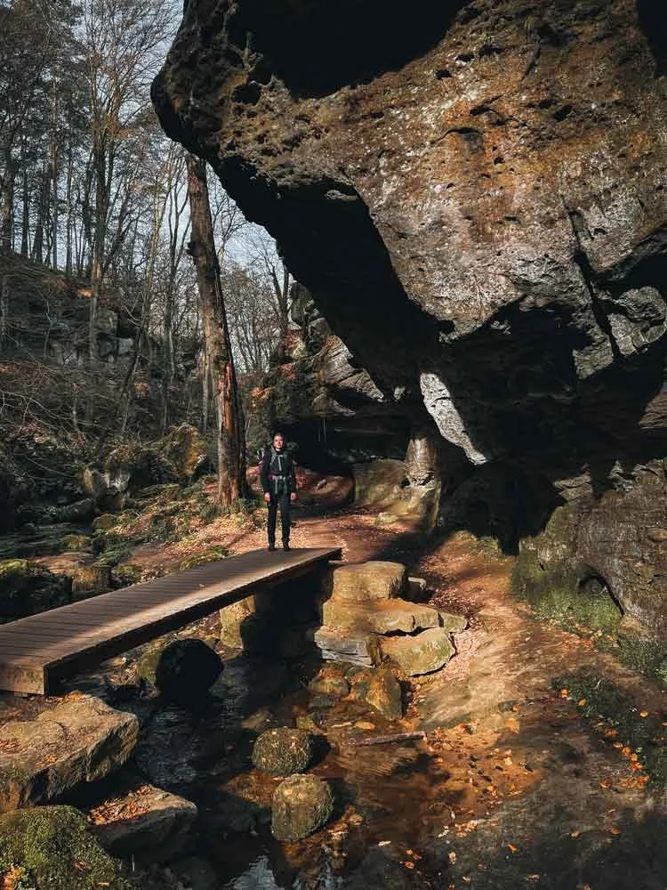
Endless forests
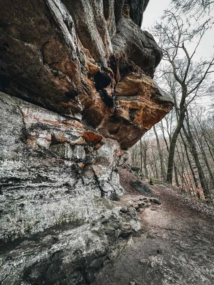
Hiking through rugged nature

Rock formations in Berdorf
The Mullerthal Trail Route 3
Mullerthal Trail Route 3 leads you through a variety of landscapes, such as forests, stream valleys, fields, farmlands, castles, and waterfalls. The trail is 38 km long and passes through the villages of Mullerthal, Blumenthal, Larochette, and Beaufort.
On the way, you can visit Beaufort Castle and see the castle ruins in Larochette. The trail also takes you past the striking Kallektuffquell spring in Blumenthal, the Schéissendëmpel waterfall in Mullerthal, the steep rocks of the Halerbaachtal, and along the Halerbaachtal and Haupeschbach streams in Beaufort.
You can read a detailed report about my experience on Mullerthal Trail Route 3 here.

Walking along and through streams

Fairy tale forests

Kallektuffquell in Blumenthal
Additional walks in the Mullerthal region
Besides the three main routes, there are four more routes in the Mullerthal region: A, B, C, and D. You can combine these extra routes with any of the main three, or walk them on their own.
For example, you can link routes A, B, and D to Mullerthal Trail Route 3, while Route C connects to Route 2.
Route A covers 22.8 km and passes through Larochette, Nommern, and Medernach. Along the way, you’ll see castles, ruins, forests, and rocky landscapes.
Route B is 13 km long and takes you through Beaufort and Bigelbach. You’ll pass an old quarry in Beaufort, walk over hills with great views, and go through dense forests. Here you walk through Bech and Altrier. On this route, you have beautiful views of the Moselle and the lower Sûre. Here, you also walk past Bildchen, a 500-year-old oak, and an ancient burial mound.
Route D is 31.4 km and goes through Bourglinster, Altlinster, Schleifmillen, Blumenthal, and Junglingster. Along this route, you’ll see charming villages, a castle, “Häerdcheslay,” a prehistoric place of worship, rock formations, and lovely forests.
Plan your route on the Mullerthal Trail
The Mullerthal Route is split into 13 sections. You can walk each one on its own or combine them as you like. Every section begins and ends in a village or town, so catching a bus is simple. Public transport in Luxembourg is also free.
1 - Echternach - Rosport 8.3 km
2 - Rosport - Moersdorf 10 km
3 - Moersdorf - Herborn 9 km
4 - Herborn - Echternach 10.5 km
5 - Echternach - Berdorf 6.8 km
6 - Berdorf - Müllerthal 6.4 km
7 - Müllerthal - Blumenthal 9.3 km
8 - Blumenthal - Larochette 8 km
9 - Larochette - Beaufort 12.4 km
10 - Beaufort - Müllerthal 7.8 km
11 - Müllerthal - Hersberg 8.3 km
12 - Hersberg - Scheidgen 8.1 km
13 - Scheidgen - Echternach 9 km
I walked each of the three routes on their own and used Komoot to plan my hikes. Below, I’m sharing my hiking maps. For routes 1 and 2, you’ll find both two- and three-day itineraries. For route 3, I’ve included a two-day plan, and I’ll add a three-day option soon.
You can download GPX and KML files for all the routes from the official Mullerthal Trail website. If you’d rather use a paper map, you can buy the topographic hiking map of the Mullerthal Trail from this shop.
Frequently Asked Questions about the Mullerthal Trail
Is the Mullerthal Trail easy to reach?
The Mullerthal Trail is easily accessible by both car, train and bus. Public transport is free in Luxembourg. If you come by car you can leave it at a parking lot or your accommodation and use the bus during your hike. Here is a link with an overview of parking lots near the trail.
When you take the train you can take busses 201, 211 or 212 from Luxembourg railway station to Echternach.
Are dogs allowed on the Mullerthal Trail?
Yes, dogs are allowed on the Mullerthal area. When I hiked there, I often saw people walking with their dogs.
How many days does it take to hike the Mullerthal Trail?
Most people hike the whole Mullerthal Trail in about six days, walking between 13 and 25 kilometres each day. You can take more or fewer days if you prefer, depending on what works best for you.
If you hike the routes separately, you can usually finish each in 2 to 3 days.
Is the Mullerthal Trail busy?
Some parts of the Mullerthal Trail can get busy. How crowded it is depends on the season and which spots are most popular. In some areas, you may hardly see anyone, but in villages, towns, or near popular sights, you might find more people.


Is the Mullerthal Trail challenging?
The Mullerthal Trail can be quite challenging in some sections. The area is hilly, and while there are no mountains, you will often come across steep climbs and descents. It's a good idea to be in good shape before you go.
Besides your fitness, the weather can also make the hike feel tougher. For example, if it rains, the mostly rocky trail can get slippery and muddy, which makes it harder to walk.
What you carry matters too. If you plan to hike with a heavy backpack, it's best to train beforehand. This way, you can enjoy your hike and lower your risk of injury.
Most people find Route 2 of the Mullerthal Trail to be the hardest, with the toughest terrain. Route 1 is usually the easiest, with more accessible paths and the least elevation gain.
Where can you stay overnight along the Mullerthal Trail?
While hiking the Mullerthal Trail, you have several options for places to stay. Wild camping is not allowed in Luxembourg, so you will need to book your accommodation in advance. There are hotels, campsites, hostels, B&Bs and holiday rentals along the route. Check the Mullerthal Trail website for more information about these accommodations.
Is the Mullerthal Trail well signposted?
The whole Mullerthal Trail is clearly marked. You'll see signs with red Ms for the three main trails and orange Ms for the extra routes. These signs appear in both directions, so you can choose which way to go.
You'll also find regular signposts along the way. These show the distance to the next villages and points of interest. At every junction where routes cross, signs clearly show which way each route goes.
Is luggage transport available on the Mullerthal Trail?
You can use Move We Carry to have your luggage transported between accommodations. This service runs from April 1 to November 30. It costs €12 per bag for each transfer, and each bag must weigh no more than 20 kg.
For more information, visit the Move We Carry website.


Are you planning to explore the beautiful Mullerthal Trail? If you have any questions about the hike, feel free to leave a comment or message me!
More inspiration and information about the Mullerthal Trail:
Mullerthal Trail Route 1: Hiking through nature and history